I had all the old TFL tools on my Sheepshaver install, probably used that - if not then it was Bartok or MythTech or something similar

They all used to be hosted here:
http://www.udogs.net/home/gfa/mapediting/index.html but now the links are dead.
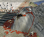
Anyway, the problem wasn't getting the height map out - I could get one ok. The problem was that Loathing is very sensitive when it comes to deciding how far to raise the mesh for white pixels, how far to drop it for black ones, and everything inbetween.
In Loathing you can choose Edit Range to set the upper and lower bounds in "world units". So if you could use TFL Loathing, you'd set the range at something large such as -5 & 5, then export it. If there's no black holes on the top of hills then you know the range encompasses all the terrain variations. Export it, then in the Myth 2 Loathing you set the range to double what you used in TFL Loathing, eg -10 & 10, as the world unit size is half TFL's in Myth 2. Import the image and it should all be exactly as it was in TFL.
When I got the displacement map from some other 3rd party tool I had no way of knowing what the height & depth range should be. Therefore when I imported it into Myth 2, things were off kilter. Either a bit too much terrain variation in heights or not enough, and it was near-impossible to get it right.
I hope that makes sense